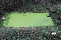
Keranaou
Lat : 48° 37′ 14.0 » N
Long : 4° 28′ 38.3 » O
Longueur : 5.00m environ
Largeur : 2.50m environ
Matériaux : pierres – ciment |
 |
|
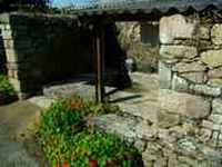
Kerandraon
Lat : 48″34’18.90 » N
Long : 4°27’29.94″‘ O
Longueur :
Largeur :
état : comblé
Matériaux : pierres – ciment |
 |
|
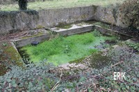
Kerezoc
Lat : 48° 35′ 13.2 » N
Long : 4° 27′ 23.3 » O
Longueur : 4.70m
Largeur : 2.50m
Matériaux : pierres – ciment |
 |
|
Kerfaven
Lat : 48° 34′ 36.5 » N
Long : 4° 27′ 13.8 » O
Longueur : 4.50m
Largeur : 2.70m
Matériaux : ciment |
 |
|
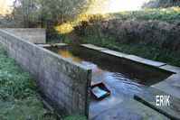
kergadavarn
Lat : 4° 29′ 46.6 »
Long : 48° 36′ 57.0 » O
Longueur : 6.10m
Largeur : 3.40m
profondeur : 0.40m
état : très bon, en service
Matériaux : ciment |
 |
|
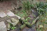
Kergaele
Lat : 48° 35′ 58.0″ N
Long : 4° 30′ 14.4 » O
Longueur : 2.70 m
Largeur : 2.1 m
profondeur : 0.40 m
hors service,privé, eau
Matériaux :pierre |
 |
|
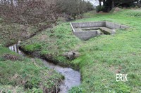
Kergegu
Lat : 48° 37′ 25.0 » N
Long : 4° 32′ 27.6 » O
Longueur : 8.10m
Largeur : 2.80m
Matériaux : ciment |
 |
|
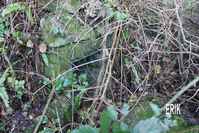
Kergouroun
Lat : 48° 37′ 04.4 » N
Long : 4° 29′ 42.9 » O
Longueur :1.90m
Largeur : 1.60m
en friche, plus d’eau
(déviation par la carrière)
Matériaux : pierre |
 |
|
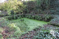
Kergreiz
Lat : 48° 37′ 04.54″ N
Long : 4° 29′ 22.44″ O
Longueur :
Largeur :
Matériaux : |
 |
|
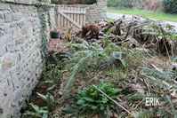
Kerhabo
Lat : 48° 37′ 04.4 » N
Long : 4° 29′ 42.9 » O
Longueur :
Largeur :
Fontaine, lavoir détuit
Matériaux : |
 |
|
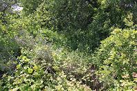
Kerlastren
Lat :
Long :
Longueur :
Largeur :
Etat : friche
Matériaux : Pierre – Ciment |
 |
|
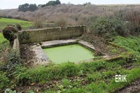
Kermoyen
Lat : 48° 35′ 13.8 » N
Long : 4° 29′ 15.5 » O
Longueur : 2.90m
Largeur : 2.50m
Matériaux : ciment |
 |
|
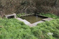
Kernevez Loguivi
Lat : 48° 35′ 30.6 » N
Long : 4° 30′ 19.8 » O
Longueur : 3.00m
Largeur : 2.90m
Matériaux : ciment |
 |
|
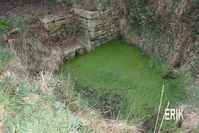
Keroudern 1
Lat : 48″36’41.10 N
Long : 4°28’07.09″ O
Longueur :
Largeur :
Etat : 2012 entretenu par l’association
Matériaux : pierre |
 |
|
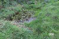
Keroudern 2
Lat : 48″36’42.12 N
Long : 4°28’05.43 » O
Longueur :
Largeur :
Etat : 2012 remis en état par l’association
Matériaux : ciment |
 |
|
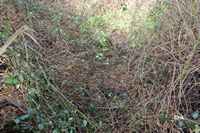
Kervili
Lat : 48″35’45.19 N
Long : 4°31’34.24″ O
Longueur :
Largeur :
Etat : friche, difficile à localiser
Matériaux :pierre |
 |
|
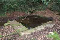
Kervolan
Lat : 48″34’59.59 N
Long : 4°28’15.18″ O
Longueur : 3 m
Largeur : 3 m
profondeur : 0.20 m
bon état, fontaine, eau
Matériaux :pierre-ciment |
 |
|
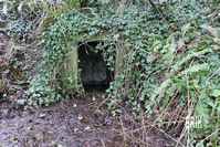
Kosker-veur
Lat : 48″37’10.90 N
Long : 4°27’29.94″ O
Longueur :
Largeur :
Etat : friche,
lavoir et fontaine
Matériaux :pierre |
 |
|
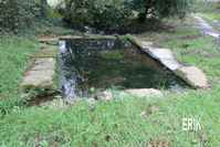
Koz-Castell
Lat : 48° 35′ 31.9 » N
Long : 4° 27′ 01.2 » O
Longueur : 5.00m
Largeur : 3.00m
Profondeur :0.30 en eau 0.40 maxi
Etat : très bon,
lavoir, bassin
Matériaux :pierre |
 |
|
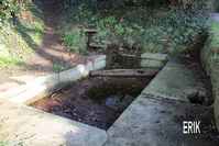
Kreach’-an-Avel
Lat : 48° 37′ 13.5 » N
Long : 4° 29′ 50.7 »O
Longueur : 4.20m
Largeur : 1.90m
Matériaux : pierres – ciment |
 |
|
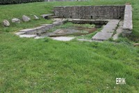
Kroaz al Lann
Lat : 48° 36′ 41.4 » N
Long : 4° 30′ 46.0 » O
Longueur : 5.80m
Largeur : 3.50m
Matériaux : pierres – ciment |
 |
|